ABOUT THE PROJECT
CHERISH used a cross-disciplinary approach to investigate past, present and near-future impacts of climate change on coastal heritage in Ireland and Wales, raising awareness of climate change in coastal communities.
PROJECT LEADs
Louise Barker and Toby Driver,
Royal Commission on the Ancient and Historical Monuments of Wales (RCAHMW)
Sarah Davies,
Aberystwyth University
Project duration:
2017-2023


Project Partners


Project Funders


The Challenge
Coastal and maritime heritage are increasingly vulnerable to the impacts of climate change, such as rising sea levels, more intense rainfall and more frequent storms. The CHERISH project brought together four government and academic organisations in Wales and Ireland to address the following key priorities:
- To target data and knowledge gaps to raise awareness of heritage in remote coastal locations.
- To establish new metrically accurate baseline data and recording standards of heritage-at-risk sites.
- To investigate selected at-risk sites on land and beneath the sea, gathering valuable research data before evidence may be degraded or lost due to the effects of climate change.
- To develop palaeoenvironment records and detailed chronologies of climate and landscape change, putting current climate challenges into a long term context.
Collectively, these initiatives supported the overall aim of raising awareness of climate change in coastal communities around the Irish Sea.

Our Approach
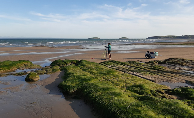
CHERISH study areas and heritage sites in Ireland and Wales were chosen based on climate change risks, with input from landowners, organisations and community groups. Selected areas represented a diverse range of environments along the coastal edge with differing susceptibilities to erosion and extended into the intertidal zone, inshore waters and offshore islands. The CHERISH project team developed an integrated and multidisciplinary ‘Toolkit’ approach to monitoring, mapping and investigating coastal heritage sites from air, on land and at sea. These included:
- Aerial photography, airborne laser scanning (ALS) or LiDAR, Uncrewed Aerial Vehicle (UAV) / drone survey, satellite coastal mapping.
- Terrestrial metric survey, geophysical survey, terrestrial laser scanning, environmental reconstruction and scientific dating, excavations.
- Marine survey using acoustic techniques and archaeological diving.
We brought the individual approaches together in a freely available publication, providing an overview and evaluation of techniques used in the CHERISH project. This publication is intended for a wide range of people and organisations who are interested in monitoring change, damage or loss at heritage sites and in understanding the wider context of landscape and environmental change.
Public engagement was an integral part of CHERISH. Activities included public talks, walks, school visits and community activities such as beach cleans.
In Wales, CHERISH supported community archaeological excavations at Caerfai (Pembrokeshire) and Dinas Dinlle (Gwynedd) in collaboration with the National Trust, Dig Ventures and Gwynedd Archaeological Trust (now part of Heneb).
Outcomes and Impact
- Marine, aerial and terrestrial survey data for at-risk sites provide baseline information for comparison with future monitoring and change detection. Installation of fixed survey markers at selected sites by CHERISH support such efforts.
- CHERISH has significantly enhanced the historic environment record, documenting previously unrecorded coastal heritage and providing new insights into selected sites from archaeological investigations and palaeoenvironmental research.
- Educational resources were produced to support classroom activities about climate change and heritage in primary and secondary schools. Bilingual resources were aligned with the new place-based Curriculum for Wales and are available on the Welsh Government digital learning platform, Hwb.
- Our work at Dinas Dinlle hillfort in Gwynedd, owned by the National Trust led to further investment for excavation of a large roundhouse that remains exposed. New information boards, digital reconstructions and an animation have enhanced public engagement and highlight the impact of climate change on coastal heritage.
- CHERISH research has contributed to government sectoral adaptation plans for the historic environment in Wales and Ireland. Working in partnership with landowners, our results have supported decision-making and climate adaptation plans.

Lessons Learnt
The relatively long duration of the project allowed us to make repeat visits to sites and build up a substantial archive of monitoring, environmental and archaeological data. This would not be practical in all contexts due to financial and time constraints but key examples such as Dinas Dinlle hillfort highlight the value of an integrated and cross-disciplinary approach at high priority at-risk sites and their surroundings.
It is very clear that communities care deeply about their local heritage sites. They are an important aspect of place-based identity. Our data on long and short term environmental change provided a valuable means of engaging in conversations about climate impacts, rates of change and possible futures.
However, this also brought challenges, for example expectations that our interventions could lead to protection or preservation of sites. Most heritage sites are unlikely to be protected and preservation by record is a key aspect of climate adaptation.

Resources and further reading
Project website – https://cherishproject.eu/en/ (English) https://cherishproject.eu/cy/ (Welsh)
CHERISH – Sharing our Practice: Investigating Heritage and Climate Change in Coastal and Maritime Environments (ISBN 978-1871184624) is available as a free download in English and in Welsh here.
Barker, L and co-authors. Learning from loss: uncovering the secrets of Dinas Dinlle, North Wales. Earth Heritage, Issue 53 p. 22-28.
Archaeology and Climate Change feature on the CHERISH project in Current Archaeology 417. https://the-past.com/feature/archaeology-and-climate-change/

